Pacifica is a city in California’s San Mateo County. It is located between San Francisco and Half Moon Bay on the Pacific Ocean’s coast. Pacifica had a population of 37,099 in 2021.
The city consists of many small valleys between Sweeney Ridge in the east, Montara Mountain to the south, and the Pacific Ocean’s rocky bluff to the west.
There are quite some hikes in Pacifica, CA, as it is a famous hiking place, with plenty of trails along the bluffs and beaches, including San Pedro Valley County Park, Mori Point, and the Milagra Ridge.
Visitors and locals are treated to a myriad of things to do in Pacifica, including equestrian trails and scenic views atop the over 100 miles of hiking.
Will you like to go hiking in Pacifica? Here are the best hikes in Pacifica, CA.
Best Hikes in Pacifica, CA
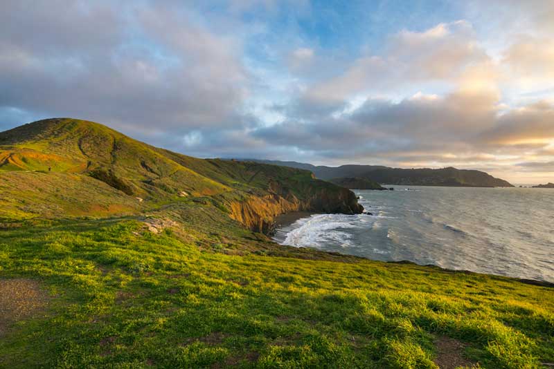
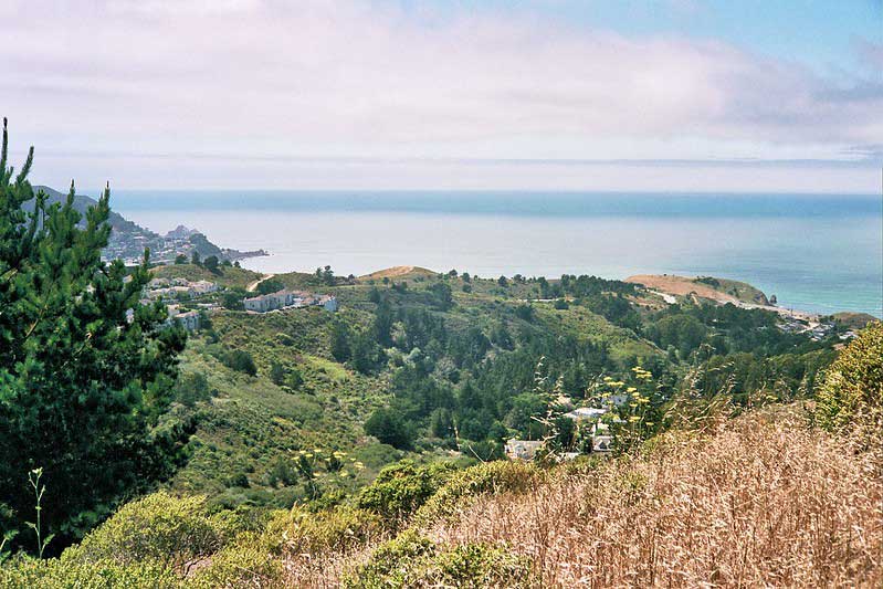
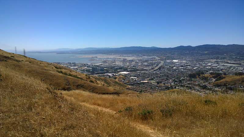
1. Milagra Ridge
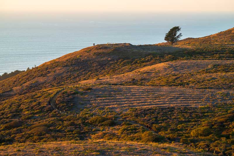
Milagra Ridge
Milagra Ridge’s scrub-covered ridgeline stretches west, offering remarkable views of Pacifica’s cliffside, the ocean, and the coast.
This safeguarded ridge is the focus of community efforts to revive the wildlife habitat and help assure the survival of many rare and threatened species in the national parkland.
The Ridge is a vital habitat for the endangered Mission Blue Butterfly and is home to Red-tailed Hawks.
The 330-acre Milagra Ridge Military Reservation was obtained in 1942 during the Second World War to be used as a coastal defense installation.
Eventually, the reservation was closed in 1972, and portions were given to the City of Pacifica in 1974.
The hiking trails are mostly paved and leveled. Visitors are expected to stay on the trails, and pets must be on a leash.
Bicycles are only allowed on the paved trail.
Address: Milagra Ridge Trail, Pacifica, CA 94044
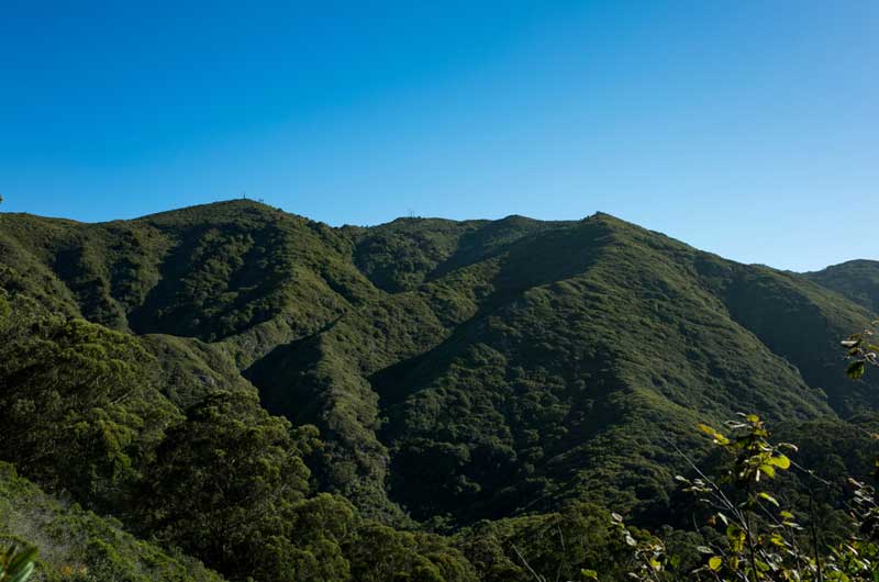
2. Sweeney Ridge
Sweeney Ridge
This destination is a federally protected hiking area between San Bruno and Pacifica.
Sweeney Ridge’s 1,200-foot high summit, coated with grasslands, slopes down to the Pacific on one side and the bay on the other.
On a bright day, you can see the city, the glittering Pacific Ocean, and the coastline. You will also see deer, hawks, and many spring wildflowers.
During spring, the hills change to gold with California poppies and many more wildflowers.
On the ridge’s crest, beyond the deserted former missile site, search for the stone plague commemorating Portola’s expedition.
A granite monument nearby leads you to this picturesque San Francisco Bay Discovery Site, including Mt. Tamalpais, the Farallon Islands, Mt. Diablo, the San Pedro Point, and Mt. Diablo.
This trail offers one of the top hikes in Pacifica, CA. It is open to equestrians, hikers, and bicyclists.
Address: Golden Gate National Recreation Area, Pacifica, CA 94044
3. San Pedro Valley Park
San Pedro Valley Park
San Pedro Valley Park lies among the foothills of Pacifica and Santa Cruz Mountain range.
The Park offers family and group picnic areas with barbecued pits, hiking trails, a self-guided nature trail, a visitor center, and views of the scenic, seasonal Brooks Waterfall.
San Pedro Valley Park is a haven for walkers. It has trails for all ages and fitness levels, ranging from the expansive vistas of San Pedro Valley to the Valley View Trail and the Pacific Oceans from the top of Montara Mountain.
The two picnic areas available for reservation are the North Walnut Grove which can accommodate 100 people, and the South Walnut Grove, which can take 200 people.
The San Pedro Valley’s facilities are mainly for day use only. There is a visitor center close to the Park’s entrance. It displays exhibits about the ecosystem of San Pedro Valley.
Dogs are prohibited in the Park, and bicycles are only permitted on Weiler Ranch Road.
Address: 600 Oddstad Blvd, Pacifica, CA 94044, United States
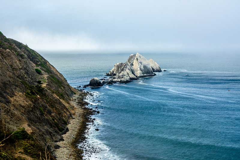
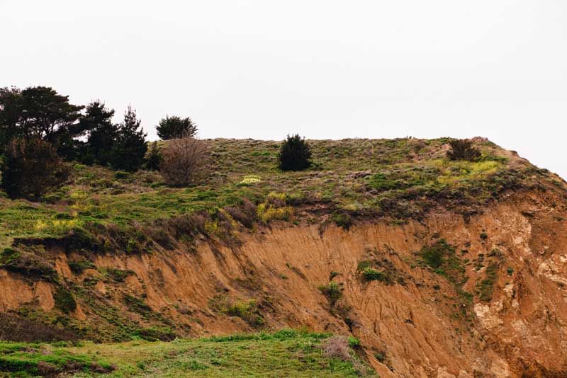
4. The Devil’s Slide
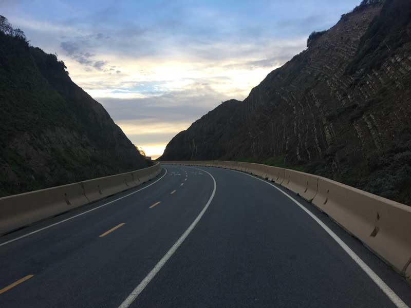
The Devil’s Slide
The Devil’s Slide Trail is a multi-purpose trail transformed from an old segment of Highway 1. It provides runners, hikers, bicyclists, and equestrians entry to Devil’s Slide’s rocky heights above the Pacific Ocean.
At designated lookouts, there are benches for relaxing and observation scopes for enjoying the view of the rocky coastal waters below.
Key points along the trails have interpretive signs that explain the history, marine geography, and communities that reside and migrate here.
The Devil’s Slide’s trail has different lanes for directional bike traffic and hikers.
Several convenient amenities, such as bike racks, pet waste stations, restrooms, and drinking fountains, are also provided.
Address: Highway 1, Pacifica, CA 94044
5. Moris Point
At Moris Point, guests can walk along the path through wildlife fields, visit renovated habitats for endangered species, and be amazed at the dramatic coastline from the upper trail that stretches to the western edge.
From the coastal blufftop, guests will be amazed at the dramatic coastline extending beyond Pacifica to the Marin Headlands and Point Reyes on a bright day.
To the south, you will be enchanted by the sudden view of the breathtaking but inaccessible secluded cove and beyond, the Pedro Point, and the Rockaway.
Visitors can see Sharp Park Beach, the Pacifica Pier, and the earthen berm backing the Coastal Trail. The top of the point is an excellent whale-watching location, and Mori Points sunsets are magnificent.
Beaches are available for relaxing and enjoying the vista. For almost a century, Mori Point served as a haven for travelers, settlers, diners, and bootleggers.
Today this superb locale serves as a haven for wildlife and hikers. Moris Point trail provides one of the best hikes in Pacifica, CA.
Address: Mori Headlands Trl, Pacifica, CA 94044, United States
6. The Hazelnut Trail
The Hazelnut Trail
The Hazelnut Trail starts at its western terminus close to the south end of Plaskon Trail and Creekside Picnic Area. It stretches to the east end of the middle San Pedro Creek valley, where it crosses with the Weiler Ranch Trail.
It links the valley of the middle and south forks of San Pedro Creek, cutting across the intervening hillside.
It carries the hiker through different plant communities where some of the park’s most native plants and their habitats can be seen up close and far away. You can appreciate the Hazelnut Trail better with the seasons.
With a plant list in tow, the interested nature lover can hike any part of the trail, view different species through seasons, or observe the animal life whose existence is significantly linked to the flora, deriving from its sustenance and shelter.
These species here range from mammals, such as foxes, bobcats, black-tailed deer, and bush rabbits, to invertebrates, such as spiders and insects, and seasonal and permanent birds, lizards, and snakes.
Address: Hazelnut Trail Pacifica, CA, USA
7. Pedro Point
Pedro Point
Pedro Point Headlands has 246 acres of wildlands in the middle of Pacifica and Devil’s Slide.
This dog-friendly park offers unique views and a wide variety of wildflowers and birds.
The mild 2.3-mile loop covers many features, trails, and parks aside from the magnificent San Pedro Rock, which can only be reached at shallow tide through a hike from Linda Mar Beach to San Pedro.
The highlight of Pedro Point is the Bluff Trail, with stunning views of the headland cliff, Devil’s Slide, San Pedro Rock, and Pacific coastline, which on bright days stretches as far as Point Reyes and Tamalpais.
Immediately you reach Pedro Summit, where there is a posted sign, you can look below at Linda Mar Beach and observe the surfers waiting for waves.
The route winds up to South Ridge Trail, continues to the far end of the Bluff Trail, and comes back through Middle Ridge and Arroyo Trail. If you are in search of the best hiking trails in Pacifica, CA, take to exploring this trail.
Address: Old Pacific Coast Highway Trail, Pacifica, CA 94044
8. The Brooks Creek Trail
The Brooks Creek Trail
Brooks Creek is a 3.5-km loop trail that takes approximately 80 minutes to complete. It offers one of the fun hikes in Pacifica, CA.
The trail is famous for hiking, walking, and running, so you may encounter other people while exploring.
The Brooke Creek Trail offers shaded and exposed stretches and provides excellent views and a fantastic diversity of flora.
The Trail connects Trout Farm close to the Visitor’s Center and Montara Mountain Trails.
The leading feature of the Brook Creek Trail is the seasonal waterfall that falls 175 feet down the side of Montara Mountain.
Visitors can only see this elusive waterfall after many days of heavy downpours.
The trail is open throughout the year and is gorgeous to visit anytime. It would be best to leave your furry friend at home because dogs are not welcome on the trail.
Address: Brooks Creek Trail Pacifica, CA 94044, USA
Also check out our list of things to do in Carpinteria, and things to do in Pomona, for a fun vacation in California.
9. Baquiano Trail
Baquiano Trail
Baquiano Trail begins from the Pacifica’s Rockaway Beach neighborhood and joins with a web of Sweeny Ridge trails close to the Portola Discovery Site.
From the Fassler Avenue Trailhead, the trail ascends 550 feet in approximately 1 mile.
Along the wide fire road, you will come across Indian paintbrush, California poppies in spring and summer, and lupine.
In Pacifica, the fog can roll off fast, so be ready for any temperature changes on the exposed ridge.
Unlike other Sweeny Ridge Trails, Baquiano Trails constantly falls victim to noise pollution from the nearby San Francisco Airport.
Expert hikers can carry on from this trail to Notchor Mori trails for extra mileage.
This is one of the top hiking trails in Pacifica, CA. Baquiano Trails is open to mountain bikers, hikers, and dogs.
Address: Baquiano Trail Pacifica, CA 94044, USA
10. Valley View Trail

Valley View is a 2-mile trail that offers hikers a clear perspective of the park’s various microclimates. It offers one of the top hikes in Pacifica, CA.
The Valley View will carry you through open grasslands with native shrubs, such as California Sagebrush and Coyote Brush.
As a result of the extensive grazing in previous years, introduced European grass species such as Wild Oats and Rattlesnake Grass frequently dominate these grasslands.
During early spring, the top of the Valley View provides hikers with the most stunning and extensive display of Wild Iris.
The heat of the south-facing slopes makes the exposed Valley View Trail the ideal place to observe the reptiles in the park.
Alligator Lizards, Western fence lizards, and rare Rubber Boa and Gopher snakes are often seen.
Other invertebrates have a fondness for the warmth of this south-facing slope. Tarantula lives in the park but stays in their burrows during the day, so they are not observed often.
There are a few benches along the trail that provide good resting spots but also act as fantastic spots from where you can view the contrasting north-facing slope and the valley floor.
Address: Valley View Trail Pacifica, CA 94044, USA
11. Sign Hill

Sign Hill
The South San Francisco Hillside Sign is a historical sign on a hillside facing South San Francisco, which is 14 minutes from Pacifica.
It was created in the 1920s. In 1996, it was listed on the National Register of Historic Places.
The sign is the leading feature of Sign Hill Park. This city park offers 30 acres of open space and approximately 2 miles of hiking trails.
Additionally, Sign Hill provides a habitat for wildlife on the San Francisco Peninsula, including the rare coast iris and endangered mission blue butterfly.
You will find colorful wildflowers like hummingbird sage, goldfields, and California poppies in spring.
Address: 650 Poplar Ave, South San Francisco, CA 94080, United States
12. Pacifica-Rockway Trail
Pacifica-Rockway Trail
Are you looking for the perfect beachside hike where you and your dog can chase the waves and admire the beauty of the Pacific Ocean?
The Rockway Point Trail is perfect for you and your leashed four-legged friend.
This famous California beach trail is ideal for catching some sun rays and watching surfers do their thing on the water.
When you have parked in one of the spaces designated for parking and selected an entrance to the beach, you can now head to the sand.
You can also follow the paved trails toward the hidden area at the end.
Here, the trails curl around, and you can take your time observing the birds and enjoying the birds before you return the same way.
The Rockaway Point Trail is not like the usual woodsy hikes. You can walk along the water where your pet can splash in the surf.
Address: 105 Rockaway Beach Ave, Pacifica, CA 94044-3253, USA
13. Gray Whale Cove Trail
Gray Whale Cove Trail
This is a comfortable hike for the entire family, with a surplus of wildflowers in the spring and magnificent coastal views while being pet-friendly.
The starting point is close to a parking lot that accesses Montara State Beach.
Follow the trail up via the coastal scrubs from the southern end of the parking lot.
Within a short time, the trail will lead you toward the ocean. You will have views of the beach under you and the World War Two military triangulation station on a peninsula over to the north.
The level trail continues to loop along the edge of the mountain before reaching a little resting point with two wooden benches that face Montara State Beach.
This is the ideal spot to watch a whale, relax and enjoy the coastal view. The trail encounters the Old Pedro Mountain trail on the left. The path will begin to go down as it approaches an old dirt road.
Before you reach the dirt road, turn to the right and trek through the cypress forest toward the highway.
When you have reached this point, you have two choices, cross the road and stroll down to Montara State Beach or return the same way you came from.
Address: Gray Whale Cove Trail, California 94019, USA
14. Montara Mountain Trail
Montara Mountain Trail
Montara Mountain is a tremendous place to catch peak views of the Bay Area while engaging your calves in some workout.
Montara Mountain Trail begins as a curling tour through the Blue Gum Eucalyptus Forest with a memorable glimpse of coastal Pacifica and the ocean.
When out of the Eucalyptus Forests, the trail offers dense coastal shrubs and ten gorgeous Manzanita groves, leading past the Brook Creek Trail Intersection.
The climb continues at a milder degree winding around the hilltop with a scenic view of the Western portion of Montara Mountain Ridge before encountering the steep flank of the Mountain.
Here, tricky switchbacks wait for you over granite rock blended with rich red clay higher and higher up the mountain. Every sequential elevation shift provides a larger view of the park below and the western coast.
The shift in elevation introduces its specialties: remarkable granite rock formation, the rare Montara manzanita, which thrives only on this mountain, and all the other coastal plant colonies that have survived at this altitude for hundreds of years.
Montara Mountain Trail offers an opportunity to use the Brooks Creek Trail intersection to hike back to the park or the more difficult option of continuing up the mountain where the trail breaks off at the San Pedro Valley Park at nearly 1,600 feet of elevation gain.
From there, the trail proceeds to the McNee Ranch State Park Property. It crosses the ridge of the Mountain with Montara Mountain Road and continues west down to Montara State Beach.
This access road is streaked with beautiful granite outcroppings. It offers the stunning vistas of Montara State Beach and Half Moon Bay on one side and San Francisco Bay on the other.
Address: Montara Mountain Trail Pacifica, CA 94044, USA
15. San Bruno Mountain
San Bruno Mountain
San Bruno Mountain is situated at the northern end of San Mateo County.
The geology of this rugged 2.416-acre park is distinct from the remaining part of the county.
San Bruno Mountain is encircled by urbanization, like Daly City, Brisbane and Colma, and South Francisco.
The Mountain has a 4-mile-long ridgeline that runs southeast to northwest. The park’s highest point, Radio Peak, is home to many radio broadcast towers.
Hiking is one of the best activities in the park. On a bright day, it offers gorgeous views of San Francisco and the surrounding Bay Area, including the Farallon Islands, Mt. Diablo, and Mt. Tamalpais.
San Bruno Mountain houses various rare and endangered plant species, with six plants that do not grow elsewhere.
You will also find three endangered butterfly species, one of which cannot be found anywhere in the world.
San Bruno Mountain is a state and country park well-known as the site of the country’s First Habitat Conservation Plan.
Address: San Bruno Mountain, California 94014, United States
Want to check out other places in California? Here are guides on things to do in Guerneville, things to do in Point Reyes Station, and things to do in Calistoga for fun exploration.
Plan a Trip to Pacifica
Pull out your hiking equipment when you get to Pacifica and explore some of the city’s best trails.
The various hikes offer memorable adventures. Ensure to come along with friends and a camera to capture precious moments.